01

Archaeology is the study of human activity in the past, primarily through the recovery and analysis of the material
and environmental data they have left behind ... that is, the "architectural record." Its motive is to record and
interpret cultures, which can range from prehistoric to the recent past. Its goal is to understand human cultures and
behaviors; rather than to simply collect "things from the past" for display and/or profit.
The discipline involves a wide variety of scientific disciplines, many of which will be touched on in the following
panels. These include both the hard and the soft sciences: Physics, Chemistry, Geology, Geography, and so forth, as
well as Anthropology and Sociology. It involves not only the field work most people only associate with the subject, but
also laboratory work and library research, since it's necessary to place the things found in the context of the lives of
the people who made and used them.
As described in the About Us page in this web site...
"The Office of State Archaeology was established at the Connecticut State Museum of Natural History (CSMNH) in 1987 to
provide technical assistance to municipalities in the preservation of archaeological sites within their communities that
might be threatened by development and vandalism.
"The OSA administers the state archaeology office at the Connecticut Archaeology Center. At this office, it maintains
comprehensive site files and maps, has in-state networks of supportive public, conducts research into the state's
archaeological sites, serves as a clearinghouse of information, coordinates the salvage of archaeological sites, and
represents Connecticut on national issues pertaining to archaeology.
"The OSA has state-mandated responsibilities for the preservation or archaeological excavation and reburial of human
remains encountered during construction activities. In this regard, it works closely with the Native American tribes in our
state for projects that effect burials and sacred sites; and the preservation of unmarked burials.
"The OSA museum serves as the repository for all anthropological collections at the university and for artifacts found
on state lands. In this role it has responsibility for the curating of Connecticut's archaeological / anthropological
collections, totaling over 600,000 artifacts.
"Finally, it works to create public awareness and support for archaeological preservation, including museum exhibits
and a variety of public presentations and activities.
"In sum, OSA works closely with federal, state and local governments in the preservation of Connecticut’s
archaeological and historical heritage."
As the following panels will hopefully show, doing all this isn't a 1-dimensional activity. But it is a fascinating one.
|
02

When people think about "archaeology" today, the image of Indiana Jones often first comes to mind.
The reality, however, is generally far more mundane, as this image shows:members of an excavation team patiently
scraping soil to locate buried artifacts, as these gentlemen are doing, and flagging and recording what artifacts were
found where, in a carefully laid-out excavation grid.
|
03

The archaeological record consists of 4 types of items, which may occur individually or in concert with other(s) at a
site. Each of these, listed below, will be examined in turn...
• Artifacts:
These are items which were made by humans and/or owes its place in a site to human activity. They have been called the
raw material of archaeology, since without them "archaeology" as such would have no meaning. They can be as varied as a
projectile point embedded in a skeleton, a stone-lined cellar hole, a cave-wall painting or etching, a
clay pipestem*, or a steel axe-head. By examining their characteristics and provenience,
archaeologists can among other things theorize their relative age, technology levels and influences, and any probable
contacts with and influences from other cultures.
• Ecofacts:
These are items which were not made by humans, but were instead the result of natural ("ecological") activity. Tree and
shellfish rings come immediately to mind; however, so do soil patterns, geological features, variations in woodland
populations (e.g., hardwood vs softwood as related to climate), types of bone remains of creatures found in bog or tar-pit
sites, seed and pollen levels, and so forth. All of these help place human activity in the context of their environment.
• Features:
Features are clusters of items which represent specific human activities. For example, artifacts associated with a site
devoted to funerals will differ from those associated with brickmaking or farming. Both artifacts and ecofacts can be
represented here, all combining to give a "picture" of what happened at a site, when it occurred, and why it occured the
way it did there.
• Archaeological Sites:
This is where the conventional archaeological "dirty-work" happens. There is more to it, though, than just the excavation:
There are numerous activities before and after work is done at a site; and the site work itself is far from haphazard.
Please see Digs: Site Activities in this web site for a more
detailed discussion of what goes on in all of these phases.
-----------------------------
*A clay pipestem might seem an odd thing to be considered significant at an
archaeological site, but it is since its characteristics can help pinpoint the site's age. Check out a discussion of this,
on this website, at pipestem info,
where one was found and quickly analyzed during a 2013 excavation. The point: No artifact is too small to be insignificant.
|
04

Artifacts are things made by people or which owe the place where they were found to people. They are, therefore, the
raw materials of archaeology.
Pictured are various projectile points (archaeologists don't refer to them as "arrow heads"), and when one thinks of
archaeology, these may be the first kinds of artifacts that come to mind. However, artifacts can range from the stone-age
technologies represented here on through the steam age and later. They can even refer to how human remains are interred,
since that's a human activity as well.
Volunteer and for-profit societies exist to explore and explain artifacts. They can range from the
Mashantucket Pequot Museum and Research Center to the
Society for Industrial Archaeology: New England Chapters
and everything in between.
|
05

Beyond telling us that they're made by humans, artifacts can also tell us something about the people themselves. The
bowl shown above, for example, doesn't appear to have much in the way of decorations incised along its rim. However, its
shape may tell us that the makers had contact with such-and-such a tribe which was located (say) 50 miles to the north,
based on finds made there. Or perhaps the timeframe within which it was created. The same can be said of the projectile
points on the previous panel.
While it's relatively easy to determine where an artifact was made when has a date and hallmark on it, prehistoric
objects are a bit trickier. There are, however, a number of resources available which will provide information to help
resolve just this issue. Several can be found on the
Related Web Sites page on this web site. Two of them are worth mentioning:
Projectile Point Types in Connecticut
and
Sequence of Pottery Types in Connecticut.
Both were produced out of the
Institute for American Indian Studies by Lucianne Lavin.
The viewer is encouraged to look these over, as well as the other resources listed on that and the
Reference Books page.
As the image above notes, however, there's more that can be found when looking at artifacts of all kinds. For
example, the visiting lecturer's subject of the 2013 FOSA Annual Meeting had to do with Maya belief systems. Among the
artifacts to be discussed will be these:

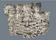
If you click on these images, a brief description of what they are will found accompanying larger versions of them.
These speak to both the level of technological sophistication exhibited by the inhabitants of the site where they were
found and to their belief systems. Not by themselves, of course, but in the context of a large amount of research into the
Maya which has been carried on for many, many years.
As with any other science, new knowledge and analysis builds on old knowledge, and enhances it as time passes.
And, clearly, the body of knowledge archaeologists have to work with continues to grow.
|
06

Ecofacts are natural elements of the environment that show up in archaeological sites - usually as food debris. The
slide is of an oyster shell, showing seasonal growth rings that allow us to know what time of the year the oyster was
harvested.
While one doesn't always think in terms of "growth rings" of oyster shells, its relevance to tree rings -- especially
in identifying conditions of moisture content -- is well known. Another "Ecofact" area would be that of pollen or seeds
found in different strata of excavation sites.
These are all ecological facts which are available to the archaeologist, either in the field or, more appropriately,
in the Laboratory once the excavated items are returned for more detailed analysis.
Webmaster's Note: For additional information on the analysis of growth layers on shellfish,
please click here to access a report on the Devil's Head Site
in Maine, where good use was made of this analytical technique.
|
07

In archaeology, a "feature" is a type of material remain that cannot be removed from a site, such as roasting pits,
hearths, and post molds. These generally have a vertical characteristic in relation to site stratigraphy.
Features tend to have an intrusive characteristic. This is not definitive as surfaces can be referred to as features of a
building and free standing structures with no construction cut can still be features. Middens (dump deposits) are also
referred to as features due to their discrete boundaries.
Among the things which are included in the definition of "feature" are: pits, walls, foundations, ditches, hearths,
graves and cisterns. The feature in the image above appears to be a post-mold: It is a clearly-defined vertical intrusion
in the surrounding ground, which has been exposed (sliced vertically downwards) to show it within the context of the
stratigraphic pattern encompassing it.
|
08

An archaeological site is a place (or group of physical sites) in which evidence of past activity is preserved (either
prehistoric or historic or contemporary), and which has been or may be investigated using the discipline of archaeology.
Sites may range from those with few or no remains visible above ground, to buildings and other structures still in use.
Generally speaking, archaeological sites contain dense concentrations of artifacts and features. They can represent
either one or several layers of human activity; for example, several state parks in Connecticut represent towns which were
established, flourished and then died out, while at the other extreme sites in the Middle East may contain remains of
activity over thousands of years and occupation by peoples with completely different historical and cultural traditions.
|
09

Site excavation is the term used to describe a series of steps and disciplines used when exploring an archaeological
site. The steps are used to both determine the most likely places where artifacts may be found and to ensure that, what
is found, is recorded and stored so that a meaningful picture of what went on there can be developed.
Among the steps taken is the marking off excavation areas in square grids (about 4 feet x 4 feet, as shown in the image
above) which are located relative to a known start point at the site (for example, a corner of a foundation), carefully
scraping back layers of soil in inches-deep sequences, photographing the location and orientation of artifacts found before
removing them, and screen excavated soil to find artifacts missed in the initial excavation.
The user is encouraged to go to the Digs: Site Activities page
and read the text at the start of each section for a more complete explanation of what goes on during each stage of the
site excavation process.
|
10

As artifacts are found, the excavation discipline includes noting and recording their physical locations, by site,
quadrant and depth. This will allow the ultimate preparation of a 3-dimensaional picture of what was found, where, in the
site.
In the image above, the depth of the arifact is being noted, with the archaeologist holding a line (held level
by a small bubble-level attached to the line, outside the picture) by which the depth can be noted by the ruler. The
corner of the grid itself can be seen by the white cords at the bottom of the image.
|
11

Site excavation requires not only "looking" for artifacts but also "seeing" them as part of a larger whole. This will
help provide the context of what's found.
For example, in the image above the projectile point is what many would focus on initially. However, whenever possible
such a find will be noted and left in place while the area immediately surrounding it is also excavated. This allows us to
see if the artifact is associated with anything else there.
The reason we excavate so carefully is the importance of vertical and horizontal control. The image was taken at a
site in Colorado with a Folsom point embedded between the ribs of an extinct bison, which died out over 9,000 years ago.
The point is located in association with the bones, both horizontally (in the same place) and vertically (in the same time).
And, knowing what the bones are from gives us a timeline for the site: It has to be at least 9,000 years old. So, what it
all tells us is that someone who made use of Folsom points had to be here 9,000 years ago for the artifact to be there;
hence, Native peoples have been in the New World a long time. The point doesn't tell us that. The ribs don't tell us that.
However, taken together -- in place, in context, in association -- they tell us that!
Note1: Generally speaking, stratigraphic analysis holds that older items are lower than items above them.
Note2: The age of the site may also be determined using various analysis techniques on the bones which are
discussed in the Physics and Chemistry panel further on.
Age may also be deterimned by use of comparison charts such as
Projectile Point Types as mentioned in the
previous panel.
|
12

The archaeologist in this image is examining the stratigraphy at this part of the site. Different colors of the soil
can provide the trained eye with an abundance of information about what may have happened in a site. Darker areas, for
example, may indicate the decomposition of organic matter; while a series of small, regularly spaced circular areas
extending down for several inches may indicate the presence of post-holes, used in building the fence of a stockade or the
pillars of a house.
A trained archaeologist can often "read" the differing layers of soil, in the same way that a geologist (even an
amateur one) can "read" the story of the geology of an area by looking at rock formations that have been exposed by
cuts in a hillside, made perhaps during highway construction.
|
13

One might think that items covered on previous panels would provide a comprehensive guide to the activities associated
with defining, excavating and interpretation of an archaeological site. However, the reality is that there is far more to
it. Among the other sciences that might get involved, each of which may utilize their own specialists and laboratories,
and all of which, taken together, help define the site, are the following, each of which will be discussed in
more detail on their associated pages:
• Geography: The lay of the land can both define and describe what went
on at a particular site, and why it did so. Among the items that a Geographer can provide input to are settlement patterns
(which buildings were placed where, and why); site location (what characteristics led the inhabitants to pick that site,
and what would the consequences have been); catchment analysis (the examination by survey, excavation, maps, and graphs of
a contained area to evaluate the productivity of the resources customarily exploited by its inhabitants); and gravity
models (which attempt to mathematically estimate patterns of trade and personal migration). Geographers' use of GPS and
GIS tools will help pinpoint both site and artifact locations.
• Biology: Knowledge of the plants and animals ("biota") associated
with a site will help us understand better how people lived there. Among the items that a Biologist can provide input to
include a reconstruction of the inhabitants' diet (and its consequences to their overall health); paleoenvironments
(environments have changed over time, becoming alternately cooler and warmer, and wetter and drier, and all will have an
impact on the biota that inhabitants will co-exist with, fight and exploit); seasonality (the environment changes over
seasons as well as centuries; what does this mean to the biota the inhabitants will encounter); the forensic aspects of
any human skeletal remains found (which includes patterns of disease, warfare, diet, burial, and day-to-day activity, and
how these are all reflected in skeletal remains); and DNA analysis (to determine either identity or genealogical ancestry).
• Geology: Geological analysis of a site will help determine both
cultural patterns and physical aspects of the site. Stratigraphic analysis will help define what existed at a site, such as
areas of toolmaking, animal husbandry and (best of all) garbage dumps which provide an all-around picture of what peoples'
lives were like); soil formation (which defines what crops and animals may have been able to be produced there, or may have
had to be imported); and lithic analysis (examination of the stone types native to the area, which also define what can be
produced locally and which would need to be imported).
• Geophysical Techniques: These are particularly useful in defining
what's where beneath and out of sight, to thereby help define where is best to excavate. Ground-penetrating radar provides
a "slice" image of what's beneath the ground based on return echoes across a swath of ground; magnetometers help locate
ferrous (iron/magnetic) materials; electrical resistivity measurements complement magnetometer analyses; and side-scanning
sonars (used in maritime archaeology to get a better, 3D-like image of what's on the bottom of a body of water).
• Chemistry & Physics: Capabilities here are particularly suited to
helping date artifacts. In Chemistry, fluorine absorption dating is a method used to determine the amount of time an
object has been underground, by measuring the amount of fluorine that has been absorbed in ground water over time; while
materials analysis will analyze and identify the types of materials (natural and manmade) found at a site. In Physics,
radiocarbon dating will determine age by measuring the amount of radioactive carbon released from an artifact when it's
been completely burned; while thermoluminescence dating attempts to measure an artifact's age based on luminescence
observed and ions released when it is heated over a period of time.
|
13A

Geography involves the lay of the land. Its concern is mostly about what's on top, rather than what's underneath. Thus
the concerns include a site's physical location, its elevation, and its surroundings (hills, valleys, rivers, etc.), as
well as the location of features and artifacts in the site itself.
Two tools of recent development which help in this process are
GIS (Geographic Information System) and GPS (Global Positioning System).
The former integrates hardware, software, and data for capturing, managing, analyzing, and displaying all forms of
geographically referenced information. GPS devices will tell you precisely where you are. GPS coordinates can be used by
GIS to localize site information; and to a large extent these tools have replaced the traditional surveyors transit for
this task. Many towns utilize GIS/GPS systems for their purposes; Connecticut archaeological sites are also recorded
using GIS, though they are not available online.
On our Student Field School Images page, the 9th image is a photo of a
portable GPS device being used. (They've gotten smaller since this photo was taken, as a quick check of Amazon
will attest.)
Two terms used in the panel above deserve being defined here:
• Site Catchment Analysis is a systematic study of an arbitrarily defined area around a series of known
sites so that the main features of such areas can be compared to check for patterning or regularity. Developed during the
late 1960s, the purpose of site catchment analysis was to reconstruct something of the economy of archaeological sites. The
size of the areas of search may be based on the sources of material found at the site or on notional working areas such as
the distance that could be travelled out from the focus during the course of a day's journey.
• Gravity Model is a model of the interaction between two population centers based on Newton's Law of
Universal Gravitation: two bodies attract each other in proportion to the product of their masses and inversely as the
square distance between them. Its original equation has been changed to accommodate features like wages, employment
opportunities, and so on, and has been widely criticized, as having no theoretical basis, instead being based on
observation only; but is still used to predict future interactions. And to help analyze past ones.
|
14

Biological sciences play a role by providing information on both the plant and animal life associated with a site, from
which a picture of the daily life of its inhabitants may have been like.
Perhaps the most common biological resource available is the presence of seed and pollen remains. These -- especially
pollen spores -- are particularly long-lived, and can be identified under a microscope hundreds (sometimes thousands) of
years after they were spread depending on climatic conditions at the time. Indeed, these will even help identify what the
paleoenvironment itself was like: hot or cold, wet or dry, and in what combinations. Furthermore, the presence of different
types of plants can identify the level of farming used, or whether the inhabitants were hunter-gatherers. The above image
of (presumably) a hearth can be a good source of such materials, especially from the surrounding soil.
Another aspect has to do with the human skeleton itself. Different environmental and cultural conditions will cause
different effects on a skeleton: A diet of in-ground tubers, eaten without washing, can result in a grinding down of tooth
enamel due to sand grit. A diet low in vitamin-C could result in scurvy and tooth loss. On the other side, skeletons with
significant numbers of healed broken bones could mean either a dietary deficiency or a society constantly in conflict with
its neighbors. Indirect indications of epidemic (such as smallpox) can be seen in sudden abandonment of settlements; though
raids by neighboring or invading peoples could also result in this.
DNA analysis of past populations is used by archaeology to genetically determine the sex of individuals, determine
genetic relatedness, understand marriage patterns, and investigate prehistoric population movements. It is also used
for far more recent investigations: In 2009, Dr. Bellantoni participated in an investigation of bones supposedly belonging
to Adolf Hitler; analysis was performed at the University of Connecticut. This was chronicled on the History Channel's
MysteryQuest series titled "Hitler's Escape", for which numerous newspaper articles can be found on the
Newspaper Articles page of this web site. (They weren't Hitler's.)
An interesting and informative entry in wikipedia on the subject of Bioarchaeology can be found by clicking
Bioarchaeology. It gets into far more detail than is possible
in the space available here; and the viewer is encouraged to examine it.
In addition, the reader is referred to an article from the New York Times "Science" section from December 18, 2012, in
which an example of Bioarchaeology is discussed, involving a skeleton, from about 4,000 years ago, found in northern
Vietnam which showed evidence of an individual -- bent and crippled by disease -- who was apparently cared for by others
in his group. The article can be found at
Ancient Bones & Compassion story.
|
15

Geology is generally concerned with what's under the surface: rock types, stratigraphic analysis, and so forth. The
knowledge and tools available to geologists help archaeologists gain a wider understanding of the availability of various
types of soils and mineralogical resources available to people ... and what they might mean. For example, there are no
places in Connecticut where flint is locally available; the nearest such site is near West Point, NY. Thus when flint implements
are found at a Native American site, the only viable conclusion is that they were transported here: by trade or conquest.
It's another piece of the larger puzzle of the site.
Different types of soils can support different types of plants, and thence animals, at a site. Its composition and how
it's formatted can be of critical importance to a hunter-gatherer and agricultural society, defining essentially what it
has to work with. While not generally thought of as a geologic issue, on relfection it clarly is.
Stratigraphy has been discssed in other panels here (7:Features and
12:Stratigraphic image). It is as relevant geologically as it is archaeologically;
and the general timewise (deeper=older) rules still apply. You just have to know what you're looking at...
In that regard, Geoarchaeology is a relatively new science to help in this. The following is an
excerpt from a Geoarcheology course
offered by Hamilton College in New York which describes what this discipline involves:
"The program ... offers an array of tools and facilities that rival those of top graduate-level research institutions.
Among them: a sedimentology lab with particle size analyzer (laser optics) and magnetic susceptibility system;
oceanographic instrumentation including a conductivity, temperature and transmissivity recorder; geochemistry facilities
including X-ray diffraction and fluorescence instrumentation and total organic carbon analyzer; rock cutting and
thin-section equipment; a complement of petrographic microscopes with photographic capabilities; hydrogeology equipment
including a digital current meter, flow cells, groundwater sampling equipment, field chemical analysis system, well-testing
equipment and a groundwater flow meter; and a computer array including Macintosh and IBM/NEC machines with a host of
software and a digitizing table."
It can be surprisingly involved.
|
16

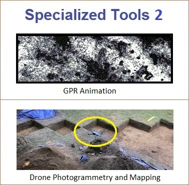
Archaeologists are increasingly looking at remote sensing methods as techniques to explore sites with minimum disruption
to the surroundings. This work is delivering new means of mapping prehistoric and historic sites in three dimensions rather
than traditional two-dimensional methods.
The tools and techniques here can be grouped into an overall category known as "Archaeological Geophysics", a good
overview on which can be found on the UK's Sussex Archaeology and Folklore website by clicking
Sussex page. In it, descriptions are provided for Resistivity Meters,
Magnetometers, and Ground Penetrating Radar. In addition, a discussion of some of these techniques can be found in the
Reprints page of this website, and can be accessed directly by clicking
Below The Surface.
• Ground-Penetrating Radar Ground-penetrating radar (GPR) is a tool that uses radar pulses to image the
subsurface. This nondestructive method uses electromagnetic radiation in the microwave band of the radio spectrum, and
detects the reflected signals from subsurface structures. GPR can be used in a variety of media, including rock, soil,
ice, fresh water, pavements and structures. It can detect objects, changes in material, and voids and cracks.
The viewer is referred to a wikipedia article on
GPR, for a more in-depth description of it, which includes several sample images; and is also referred to
an article reprinted from one of our FOSA Newsletters, which describes the use of Ground Penetrating Radar in 2006. You
can access it by clicking here.
Ground-Penetrating Radar (GPR) is shown in use on the next panel. Also in the
Excavate, Level by Level page of the "Digs: Site
Activities section, the 9th image is a photo of a metal detector being used.
• Magnetics (and Electrical Sensitivity) is another remote sensing technique that offers ease-of-use and
cost-efficiency. Magnetometry and gradiometry resolve many structures, including buildings, cooking sites, furnaces used
for smelting, burial grounds and other types of buried subsurface objects. The reasons for the effectiveness of magnetics
in archeology are related to several factors, including alteration of magnetic properties due to fire and magnetic
susceptibility contrasts in soils. The viewer is referred to the website of GEM Systems,
which produces these devices; and to here
which describes their use in archaeological applications, including several very interesting articles accessible from the
latter.
The lady in the image above is using a magnetometer, which can detect differences in magnetic field-strength as much
as several feet beneath the surface. Standard metal detection devices, which are good for depths down to about 6-12 inches,
have also proven useful in locating metallic artifacts as well as the sites where they may have been manufactured.
• Side-scanning sonar is a category of sonar system that is used to efficiently create an image of large
areas of the sea floor. It may be used to conduct surveys for maritime archaeology; in conjunction with seafloor samples
it is able to provide an understanding of the differences in material and texture type of the seabed.
The viewer is referred to the following wikipedia article
on side-scanning sonar for a more in-depth look at this subject. (Side-scan sonar was used in the search for the
pirate Blackbeard's ship, the Queen Anne's Revenge, as described by Dr. Richard Lawrence to FOSA during our
2008 Annual Meeting.
• Metal Detectors are of potentially valuable use, both working a site and in locating it in the
first place. Unfortunately, many metal "detectorists" unwittingly ruin the archaeological significance of a site
or the artifact itself when they remove it from its resting place, especially when they're using the detectors
on their own. Both sides of this issue are discussed in a New York Times article (January 16, 2017) which you
can access by clicking
Metal
Detectors, which is also accessible from our
Newspaper Articles page.
|
17

Ground Penetrating Radar (GPR), here being pulled by a volunteer, is a nondestructive method of using the returns of
electromagnetic pulses to create an image of subsurface structures in a site. It takes vertical "slice" images while being
pulled back and forth along the surface according to parallel pathways laid out on the ground. In this way, the location
of solid objects (rock, foundation stones, metal objects, etc.) can be found.
The rocky soil of New England can reduce the effectiveness of this tool in many instances; however, as can be seen
from this photo taken in Connecticut, not in all of them.
To read an article on the use of GPR and its limitations, including its use by the State Archaeologist, please
click here for an ariticle in the January,
2014 issue of CSA News (CSA = "Crops, Soils, Agronomy").
There are additional articles in this web site on GPR; the reader is encouraged to use the Google search capability
in the Google Search page -- input GPR or ground penetrating
radar into the text box, and click the "FOSA" button -- to access them.
|
18

The techniques for determining the age of artifacts or other materials recovered from an archaeological site are
technically complex. As a result, using them generally requires sending the item (or a piece of it) to a special
laboratory where the analysis can be performed under exacting conditions. Thus the descriptions below will only be of
a high-level; though links to other sites dealing with them are provided.
CHEMISTRY
• Fluorine absorption dating is a method used to determine the amount of time an object has been
underground. It can be carried out based on the fact that groundwater contains fluoride ions. Items such as bone fragments
that are in the soil will absorb fluoride from the groundwater over time. From the amount of absorbed fluoride in the item,
the time that the item has been in the soil can be estimated.
The dating method is a relative one because one needs another item found in the same area of which the age is known to
state anything about a true age. If no real age is known, ages can only be expressed in older than or younger
than between the two objects. The fluctuating amount of fluoride found in groundwater means the objects in comparison
must be in the same local area in order for the comparisons to be accurate. As not all objects absorb fluorine at the same
rate, this also undermines the accuracy of such a dating technique.
For additional information on fluoride dating from Palomar College, please click
Palomar College.
• Materials analysis in Archaeology aims to characterise the materials used by past people, using
approaches adapted from the natural sciences. The range of materials includes natural (stone, bone, wood, leather,
textiles, plant and animal remains, and soils) and artificial (ceramics, metals, pigments, glass) substances.
This link will bring you to the website of a firm which specializes in this work
ArtifactLAB.
PHYSICS
• Radiocarbon dating uses the amount of Carbon 14 (C14) available in living creatures as a measuring stick.
All living things maintain a content of carbon 14 in equilibrium with that available in the atmosphere, right up to the
moment of death. When an organism dies, the amount of C14 available within it begins to decay at a half life rate of 5,730
years; i.e., it takes 5,730 years for 1/2 of the C14 available in the organism to decay. Comparing the amount of C14 in a
dead organism to available levels in the atmosphere, produces an estimate of when that organism died.
Radiocarbon dating is used by OSA; and FOSA maintains a separate fund to help facilitate these analyses. In addition, several
articles from FOSA Newsletters describe both radiocarbon dating and results we've obtained; these can be access by clicking
Newsletter Reprints. A more detailed description of
C14 dating theory and techniques can be found at Web Info: C14.
• TL (Thermoluminescence) dating involves examination of the luminescence associated with the gradual
heating of a material, as well as analysis of the released ions resultant from the heating. Like radion-carbon dating,
estimates of the age of the material can be made via the amount of ionized materials released as compared to the
non-ionized material.
The mechanics of thermoluminescence dating are too complex for this page; however, the reader is encouraged to examine
this web site, TL FAQs, for additional information.
|
19

Laboratory Analysis is what's done when artifacts are returned from the excavation site.
At its most fundamental, this involves measuring the artifact, identifying what they're made of, and storing them in
plastic bags, on which this information -- as well as when, the name of the site, and the grid location and depth where
they were found -- are recorded.
More detailed analyses can be done in laboratories with the specialized equipment to do it; a good example of one
such is at the Pequot Museum in Ledyard, CT. Where Carbon-14 dating analysis is needed, this can be done at specialized
laboratories as well.
Results of these analyses are ultimately intended to be entered into a
"PastPerfect Museum Software" database. From
all of this, ultimately a 3-dimensional map of the site can be derived if appropriate.
Note: A more complete list of activities covered under this topic can be found in the
Volunteer Opportunities: Laboratory Work section of this
web site.
|
20

This lady is in the process of carefully scraping off layers of soil, and brushing soil particles off something which has
caught her eye, in an effort to locate artifacts in situ. This is all done very carefully so as to not disturb the
location and orientation of anything encountered ... digging with the point of a trowel is strictly discouraged!
Part of this effort involves noting the depth and position of an artifact within a grid, the location of which has
been meticulously defined on the property. Other activities here include sifting the excavated soil through a screen, in
order to find any artifacts that might have been missed.
The viewer can see photos and descriptions of all of the major steps in a site excavation in the
Digs: Site Activities page of this web site.
|
21

Perhaps surprisingly, over 5,000 archaeological sites are listed in the Connecticut site files. The map gives some
indication of where they're located: All over the state. These sites date from over 11,000 years ago and the first
peopling of the state, up to 50 years ago. However, many of them no longer exist: they're now buried under highways or
other constructions, excavated away, lost to natural activities (e.g., erosion), and so forth. Others are on private
property and are not publicly available.
The OSA does maintain a database of sites in Connecticut; however, while site information is available, sites'
locations will often be restricted. Further, depending on the site, some restrictions may be placed on who gets to see
various parts of the documentation.
A primary reason for these restrictions is to prevent information getting out to potential site looters. Also, many of
these sites are on private property whose owners do not want information to be made available.
|
22

Human beings have been present in the New England area for at least 13,000 years, a span of time far, far longer than
the 5 centuries since 1492. During the pre-Columbian period, profound technological and social advances occurred, and
population levels over the hemisphere grew from a few hundred to millions of people.
It's the job of Pre-Contact Archaeology to attempt to determine how these Native Americans lived. Essentially these
were stone-age peoples, living close to the land; which means that the evidences available to archaeologists, and how
conclusions can be drawns from them, are fundamentally different than those available to post-Contact ("Historical")
peoples.
Studies have shown that both the populations and climate have changed, sometimes radically, during this pre-Contact
period; and how the peoples adapted to them culturally and interpersonally, has changed as well. The heritage bequeathed
not only to these peoples' direct forebears but to the rest of the population of our area, is one which we all have a
responsibility to understand and preserve.
As noted on the first panel of this series, meeting this responsibility is a
mandated requirement of the State Archaeologist. It's also a passion for the many professional and volunteer archaeological
groups who help in this endeavor; and even more so for Native American organizations themselves, most particularly in
Connecticut at the Mashantucket Pequot Museum and Research
Center, whose activities encompass both archaeological and cultural/research endeavors;
(The Museum's research is recorded in our FOSA Newsletter articles, and is reproduced in the
Reprints section.
|
23

It's the job of Historical Archaeology to interpret what happened once European peoples arrived at and settled in North
America, and how their cultures and those of the Native Americans dealt with each other; as well as how the culture of the
European settlers themselves evolved over time.
These were not, of course, stone-age people, but instead were metal-age peoples who have also left written records of
much of what happened, in the years between about 1600 and today.
But such records do not exist for everything. For instance, towns have been established, flourished and were then
abandoned; what's left in the written record is often incomplete; and what's left in the archaeological record is even
more so. This is true whether we're talking about a town such as Gay City in Hebron, CT, which has long since been
abandoned, or if we're talking about the loss of mills and other industries in towns all across the state, where abandoned
factories litter the landscape like forlorn skeletons of productive times past.
The archaeological tools needed to research these are often the same as when dealing with Pre-Contact peoples' sites;
what remains is often more material than that left by Native American societies. How the results of these tools are to be
interpreted may be necessarily different than for Pre-Contact peoples, but no less important, for the statute on the
first panel doesn't differentiate between our Pre- and Post-Contact archaeological
heritage ... nor should it.
|
24

Whenever human remains are uncovered anywhere, the State Archaeologist is likely to be called in to examine them. This, at
a minimum, will be to determine whether the person died as a result of recent foul play (which will mean a police
investigation), or whether it's more mundane: for example, the exposure of a long-forgotten family burial ground.
In addition, if it's determined that the deceased is a Native American (perhaps by skeletal characteristics, or if it
was found arranged in a fetal position), the matter will likely be referred to local Native American tribal members so that
reburial can be done following Native American practices. (This is in compliance with the Native American Graves Protection
and Repatriation Act, also known as NAGPRA.)
Note: The reader is referred to the
Reprints Home page of this web site. There are a number of articles, which have been reprinted from our FOSA
Newsletters, relating to Native American reburials as well as on various excavation techniques and tools used.
|
25

Judging by the date and content of the image, it's likely that this skull was associated with the torso of the previous
image, but perhaps physically separate from it. There are any number of reasons why this may have happened, most of which
are what we'd call benign. However, other possibilities also exist...
The subject of one of Dr. Bellantoni's talks (most of which are open to the public ... check out our
Upcoming Events page) has to do with vampirism beliefs in colonial New
England, and attempts by people living at the time to deal with them. One of these involved separating the
head of the deceased from the torso.
Those dealings has nothing to do with the contemporary (and, in this context, rather silly) movies available on
vampires today. Rather, such activities were attempts to ward off the unexplained deaths of family members, at a time when
nothing else worked and no rational alternative explanations for the deaths were available.
Dr. Bellantoni described these in an article in Connecticut magazine in May, 2012, going into what was found
and why skeletons were rearranged as they were ... and why. The viewer is encouraged to read the article, which can be
accessed by clicking
Nick Bellantoni Interview.
|
26

These panels began with a reference to Indiana Jones. If nothing else, it's hoped that those who have gotten this far
understand that what Dr. Jones portrays is not what is known as "archaeology" today. There are local, state and
federal regulations in place which need to be followed if we're to understand and preserve our archaeological heritage.
This even extends to the perhaps counterintuitive practice of
Site Preservation, in which excavation work at a site is filled back in so that it can be examined in the future, when
better tools and enhanced understanding of what the finds represent will exist.
Not everything can ever be done "by the book" as it were. People will always come across projectile points, hearths,
pioneers' tools, and whatnot in their fields or even back yards. They'll nearly always collect them; and often without
contacting the Office of State Archaeology beforehand. (Not always, thankfully.) The problem with doing this is that of
provenience: often the artifacts are found and collected without recording when, where, how deep, etc. they were found.
And while it's all well and good if the collections are then given to the OSA later on, their utility is often lost:
there is no context within which they can be placed. Archaeologically, they're unfortunately of little value.
Still, laws regarding the mechanics of archaeological excavations, and the desire to protect archaeological sites,
mean that the awareness of the need of doing these things is recognized. And the work of the OSA, of FOSA and of its
sister organizations is intended to help conform to these ... and to help conserve our archaeological heritage.
|
27

As the panel suggests, careers in the field of archaeology can be quite varied, and admittedly, limited. Traditionally,
an archaeologist works as a professor in a university and conducts fieldwork and research in conjunction with students that
is funded by the university or grants. Teaching college courses is also a part of the job. A PhD is required for this kind
of position.
Some archaeologists work for museums such as the Smithsonian Institute, the American Museum of Natural History, and the
Mashantucket Pequot Museum and Research Center. Archaeologists working for a museum often conduct research that is aligned
with the museum's mission and are responsible for the museum's archaeological collections. A Masters degree or a PhD is
often required for this kind of work.
Archaeologists can also work in the field of cultural resource management (CRM). Archaeologists working in CRM are
often employed by a federal or state agency to ensure that the agency is complying with federal and/or state laws that
require the consideration of cultural resources (which includes archaeological sites) when any undertaking is initiated by
the agency. Environmental and preservation laws include the National Environmental Policy Act, the National Historic
Preservation Act, and the Connecticut Environmental Policy Act, amongst others. A Masters degree at minimum is often
required for this type of work.
Contract archaeologists also fall under the broader umbrella of CRM. Often a private archaeological company will be
hired by a federal or state agency to conduct an archaeological survey of an area that will be impacted by a construction
project to identify and possibly excavate archaeological sites prior to construction. A college degree is often required
for this type of work, while a graduate degree is required for management positions.
Forensic Archaeologists may work for a police force to aid in recording and evaluating a crime scene. A graduate degree
is often required for this type of work.
The viewer is urged to review a comprehensive Frequently Asked Questions paper put out in 2008 by Texas A&M University
on this subject, including lists of popular and text books, training requirements to become a professional
archaeologist, placement services, and other information. (Note: At this writing, in
January 2021, the first 2 articles of the 4 represented are no longer available. The
2 that are available are...
> Ask the Experts: AIA Archaeology FAQ, by the
Archaeological Institute of America (AIA); and,
> Is a Career in Archaeology Right for You?
by K. Kris Hirst of ThoughtCo (education resources).
|
28

While not part of Dr. Bellantoni's on-site lectures on Archaeology, the Facebook's "About Archaeology" page
is devoted to the description of a number of the subdisciplines within Archaeology.
The reader is encouraged to examine this page, and to explore in more depth those subdisciplines which are of interest
to you.
You can access this page by clicking here
and signing in with your Facebook ID and Password.
<
|
29

This is the first of a set of 3 panels which is also not part of Dr. Bellantoni's normal presentation; rather, it's
taken from an Outreach Table exhibit done in 2014. The nature of the subject, "The Archaeological Investigation and
Excavation of Potential or Proven Burial Sites," is unique enough that it was felt worthy of its own set of panels. This
set is derived from the Old Newgate Prison Burials project, a Fall, 2004 account of which is available in the "Reprints"
section of this website, and which is directly accessible by clicking
Old Newgate Prison article. Note that this exhibit
was not focusing on formal cemeteries.
Burials are sometimes accidentally discovered, such as the one uncovered in a commercial gravel pit in Preston, CT (see
the image at the upper-left in the photo above and its larger version, which can be accessed by clicking the image).
Others may take hundreds of hours of research, inverviews, meetings and investigation such as occurred with the Old Newgate
Prison investigations in Granby, CT.
Included in the images are photos of some of the technologies used to determine the location of a potential site,
including a Metal Detector, Magnetometer, Ground Penetrating Radar (GPR), and that old standby Walking Around. To read
an article in the Reprints section of this website on below-the-surface technologies by Debbie Surabian, who is featured
in the second-from-left photograph at the bottom of the image above, please click
Beneath the Surface article.
|
30

No two sites are alike......
Once a potential site is established, the next step is to ascertain the area where to begin excavation.
Many different factors go into making this decision, such as terrain, type of interment and information already known,
if any, about the burial location.
Various methods used in evaluating a site, which are shown in this panel (though from one site to another they won't
necessarily be performed in the order represented), running clockwise starting from the upper left:
> A Site Survey is done, to establish a Datum Point which will be used as a single reference point for excavations
which are subsequently done once the viability of the site has been established.
> A Circle Search may be done. This is also used in Marine Archaeology, viewing an area in ever-wider circles in order
to check an area as thoroughly as possible.
> Judgemental test pits and trenches are dug, checking for variations in soil coloration and composition, as well as for
evidence of prior soil disturbance.
> Soil probes and exploratory trenches are made.
> Soil is tested for acidity, to determine the likelihood of metals and organic material being present, such as bone,
coffin hardware and wood.
Such activities are in support of activities ranging from a search for historical artifacts, to searches for burial
sites as occurred at the Newgate Prison excavation, and as part of police investigations.
|
31

The caption at the bottom of the image bears repeating here...
"Respect for cultural and religious beliefs and traditions are of utmost importance.
When human remains or evidence of remains is revealed, they are left undisturbed if at all possible.
If exhumation becomes necessary, efforts are made to identify and locate descendants so that reinterment can be
performed per the family's wishes.
When identification is impossible, attempts are made to determine ethnic or cultural background in order to carry out
reinterment in a proper and respectful manner."
In light of this, it's suggested that the viewer read several other Reprinted articles in this website:
> A Long Trip Home: The 112 Year Journey of Albert Afraid of Hawk, concerning the location, exhumation,
and return to South Dakota of a Lakota Sioux member of Buffalo Bill Cody's Wild West Show, who passed away in Connecticut
in 1900, and which can be accessed by clicking
Albert Afraid of Hawk.
> Henry Obookia and His Delayed Trip Home, concerning the location, exhumation and return to Hawaii of
Henry Obookia (or "Opukah'ia" as it's more properly spelled), who came to this country on a sealship in 1817 and passed
away in 1818, which can be accessed by clicking
Henry Obookia.
> Ground Penetrating Radar in Historic Deerfield Cemetery describes the use of Ground Penetrating Radar
in searching for a mass burial site at Historic Deerfield Cemetery. This article can be found by clicking
Deerfield Cemetery.
> Skeletons Uncovered at Hospital Construction Site by Nick Bellantoni, on the discovery of human remains
uncovered at a hospital construction site in New Haven. This article can be accessed by clicking
Hospital Construction Skeletons.
Still, laws regarding the mechanics of archaeological excavations, and the desire to protect archaeological sites,
mean that the awareness of the need of doing these things is recognized. And the work of the OSA, of FOSA and of its
sister organizations is intended to help conform to these ... and to help conserve our archaeological heritage.
|
32

There are an increasing number of Videos and Television Specials which are available both online and in
libraries.
One video available online, the "Connecticut Archaeology Road Show", is presented by FOSA members Gary Nolf
and the late Don Rankin. They normally present the Road Show to museums, historical societies and libraries, promoting
an understanding and respect for Connecticut archaeology. Talks include the geology of Connecticut and how it
impacted Native Americans living there, a history of the activities and methods of the area's hunters and
gatherers, and a discussion of Uncas and the Pequot War. To see a half-hour video of Gary and Don discussing the
Road Show on an episode of Branford Public Television's "Classroom Connections" show, please click
Archaeology Road Show.
The National Geograhic Channel and Connecticut Public Television have also presented a series entitled
"Time Scanners", which depicts use of 3D laser scanning to generate point-cloud and CGI imagery of the Great Pyramid
of Giza, the internals of St. Paul's Cathedral in London, and examination of the visible and hidden aspects of
the settlement at Petra. While no longer actively being shown, information on videos and other aspects of the
episodes can be accessed by doing a Google search using time scanners pbs as the search criteria.
And the Smithsonian Channel has produced "Stonehenge Empire", an exploration of Stonehenge undertaken as
a part of the 'The Stonehenge Hidden Landscape Project. Using aerial analysis as well as Ground Penetrating
Radar, a number of previously unknown aspects of Stonehenge have been unearthed. A write-up on this can be
found by clicking
Stonehenge Empire. Note that this episode as well as its companion Ghosts of Stonehenge can also
be found on NOVA on CPTV and CPTV Spirit.
Note that by accessing Google you can find information on these episodes and also episodes which can be
viewed online.
Please note that these last are NOT an advertisement for these shows, merely recent examples of them. As
new remote sensing techniques are brought to bear on archaeological sites, our understanding of them expands
manyfold. Check your TV listings frequently.
> Polynomial Texture Mapping (PTM)
Description of the analysis tool, which uses multiple illumination sources to bring out features on artifacts
that might otherwise go unnoticed, and its use in analyzing the Antikythera Mechanism.
>
Multispectral Imaging which can be considered analogous to PTM except that in this case an
artifact is examined using different wavelengths of light covering infrared and visual parts of the spectrum. In
the article linked to, from the September/October 2017 issue of Archaeology magazine, discusses how it's
used to read biblical-era writings on pottery shards.
> 3D Printing Use in Archaeology
Watch as a 17th-century ivory sundial compass is scanned using a 3D scanner and then reproduced using a 3D
printer. Finally, the reconstructed object finds its way into the visitor's hands during the archaeological
tours of James Fort.
> Jamestown "Jane" Reconstruction"
This is a more intriguing video, in which the skull of a young female unearthed in Jamestown pit was rebuilt
using 3D scanning and printing. The skull had been extensively damaged, with a number of pieces missing. However,
with the use of 3D scanning of the parts available, followed by use of "mirroring" software to reconstruct many
of the missing pieces, 2 skulls we 3D printed, one of which was used as a base onto which clay was added to
rebuild what the young woman looked like while alive. A good example of forensic archaeology coupled with 3D
scanning and printing. Dr. Douglas Owsley, who was the guest speaker in our
2015 Annual Meeting featured in this video.
> How Does LiDAR Remote Sensing Work? Light Detection and Ranging
LiDAR is one of the newest and most useful tools available to archaeologists for determining "What's underneath?"
without having to dig. The video above has its silly elements but, nevertheless, can provide a good overview
of the benefits of this tool. In addition, we strongly recommend the book, Archaeology From Space: How the
Future Shapes Our Past by Sarah Parcak. In it, Ms Parcak shows the evolution of satellite archaeology, in
which LiDAR plays a central role, be it in the deserts of the Saraha to the jungles of the Amazon.
|
33

Every trade has its own set of specialized tools to help its practitioners do their jobs better; and
Archaeology is no different.
In this picture we see examples of such tools, taken from other pages in this web site.
On the left is the Kaolin Pipestem Measurement Tool. Kaolin is a type of clay used in making
disposable pipes from the early 17th century thru the late 19th century. Its use was widespread, and age can be
determined from several factors, including bowl designs and pipestem diameters. The latter was develped by J.C.
Harrington.
The approximate manufacture date of a kaolin clay pipestem fragment (A) can be determined by measuring its
inner diameter. In this case, that diameter (5/64 of an inch) suggests a manufacture date of between 1720 and
1750 (B).
Information on kaolin clay can be found by clicking
kaolin clay.
Information on the Harrington method (as well as others) can be found by clicking
Pritchard Shipyard Kaolin
Pipe Analysis, a South Carolina 2004 archaeological paper.
On the right the archaeologist is using what's called a "Munsell Soil Chart" booklet to determine
objectively the color of the soil sample he's holding on the tip of his trowel. Through a series of codes, he
can record not only its color but also characteristics of the soil itself, avoiding descriptive ambiguities such
as "yellowish brown" vs "browinsh yellow."
For information on Munsell charting methods and codes, please click
Munsell Charts.
|
34
These panels began with a reference to Indiana Jones. If nothing else, it's hoped that those who have gotten this far
understand that what Dr. Jones portrays is not what is known as "archaeology" today. There are local, state and
federal regulations in place which need to be followed if we're to understand and preserve our archaeological heritage.
This even extends to the perhaps counterintuitive practice of
Site Preservation, in which excavation work at a site is filled back in so that it can be examined in the future, when
better tools and enhanced understanding of what the finds represent will exist.
Not everything can ever be done "by the book" as it were. People will always come across projectile points, hearths,
pioneers' tools, and whatnot in their fields or even back yards. They'll nearly always collect them; and often without
contacting the Office of State Archaeology beforehand. (Not always, thankfully.) The problem with doing this is that of
provenience: often the artifacts are found and collected without recording when, where, how deep, etc. they were found.
And while it's all well and good if the collections are then given to the OSA later on, their utility is often lost:
there is no context within which they can be placed. Archaeologically, they're unfortunately of little value.
Still, laws regarding the mechanics of archaeological excavations, and the desire to protect archaeological sites,
mean that the awareness of the need of doing these things is recognized. And the work of the OSA, of FOSA and of its
sister organizations is intended to help conform to these ... and to help conserve our archaeological heritage.
|
IMAGES INDEX
Click on an icon to jump directly to its image and description.
|


")
")


")
")
")


")
")


